
St. Francois County
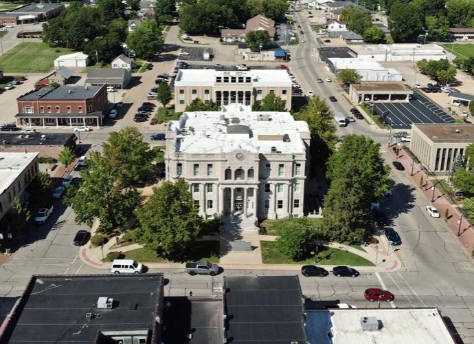
St. Francois County is a county located in the Lead Belt region in Missouri in the United States. As of the 2010 U.S. Census, the county’s population was 65,359. The largest city and county seat is Farmington. The county was officially organized on December 19, 1821. It was named after the St. Francis River. The origin of the river’s name is unclear. It might refer to St. Francis of Assisi. Another possibility is that Jacques Marquette, a Jesuit who explored the region in 1673, named the river for the Jesuit missionary Francis Xavier. Marquette had spent some time at the mission of St. Francois Xavier before his voyage and, as a Jesuit, was unlikely to have given the river a name honoring the Franciscans. Natives pronounce the county’s name as if it were the English “Saint Francis.”
St. Francois County is a component of the Saint Louis CSA also known as Greater St. Louis and consists of several commuter cities of St. Louis.
Data for St. Francois County
Data for St. Francois County
County Maps
The following maps are available for St. Francois County:
- Aerial Photos
- Cities
- County
- Parcels
- Roads
- School Districts
Supported Web Browsers:
- Google Chrome
- Microsoft Edge (does not include Edge Legacy)
- Mozilla Firefox
- Safari
(Only WebGL-enabled, 64-bit browsers are supported.)
Troubleshooting:
If you’re having trouble viewing the web maps, please consider the following.
ESRI maps require a browser that supports WebGL, which is essential for loading the maps properly. If your browser doesn’t support WebGL, you may encounter issues when accessing the maps.
To check if your browser has WebGL enabled, visit WebGL Test. (You should see a spinning cube.)
If your browser does not support WebGL, please update your browser or switch to one that does.
Thank you for your understanding.
- Zoning
- Water System (requires login)
- Fire Hydrant Locations
Supported Web Browsers:
- Google Chrome
- Microsoft Edge (does not include Edge Legacy)
- Mozilla Firefox
- Safari
(Only WebGL-enabled, 64-bit browsers are supported.)
Troubleshooting:
If you’re having trouble viewing the web maps, please consider the following.
ESRI maps require a browser that supports WebGL, which is essential for loading the maps properly. If your browser doesn’t support WebGL, you may encounter issues when accessing the maps.
To check if your browser has WebGL enabled, visit WebGL Test. (You should see a spinning cube.)
If your browser does not support WebGL, please update your browser or switch to one that does.
Thank you for your understanding.
- Zoning Map (open to public)
Supported Web Browsers:
- Google Chrome
- Microsoft Edge (does not include Edge Legacy)
- Mozilla Firefox
- Safari
(Only WebGL-enabled, 64-bit browsers are supported.)
Troubleshooting:
If you’re having trouble viewing the web maps, please consider the following.
ESRI maps require a browser that supports WebGL, which is essential for loading the maps properly. If your browser doesn’t support WebGL, you may encounter issues when accessing the maps.
To check if your browser has WebGL enabled, visit WebGL Test. (You should see a spinning cube.)
If your browser does not support WebGL, please update your browser or switch to one that does.
Thank you for your understanding.
- Wastewater System (requires login)
- Water System (requires login)
Supported Web Browsers:
- Google Chrome
- Microsoft Edge (does not include Edge Legacy)
- Mozilla Firefox
- Safari
(Only WebGL-enabled, 64-bit browsers are supported.)
Troubleshooting:
If you’re having trouble viewing the web maps, please consider the following.
ESRI maps require a browser that supports WebGL, which is essential for loading the maps properly. If your browser doesn’t support WebGL, you may encounter issues when accessing the maps.
To check if your browser has WebGL enabled, visit WebGL Test. (You should see a spinning cube.)
If your browser does not support WebGL, please update your browser or switch to one that does.
Thank you for your understanding.
- Leadwood Sewer System (requires login)
Supported Web Browsers:
- Google Chrome
- Microsoft Edge (does not include Edge Legacy)
- Mozilla Firefox
- Safari
(Only WebGL-enabled, 64-bit browsers are supported.)
Troubleshooting:
If you’re having trouble viewing the web maps, please consider the following.
ESRI maps require a browser that supports WebGL, which is essential for loading the maps properly. If your browser doesn’t support WebGL, you may encounter issues when accessing the maps.
To check if your browser has WebGL enabled, visit WebGL Test. (You should see a spinning cube.)
If your browser does not support WebGL, please update your browser or switch to one that does.
Thank you for your understanding.