
Washington County, Missouri
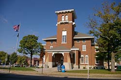
Washington County is a county located in the eastern portion of the U.S. state of Missouri. As of the 2010 census, the population was 25,195. The largest city and county seat is Potosi. The county was officially organized on August 21, 1813, and was named in honor of George Washington, the first President of the United States.
County Maps
The Washington County Assessment Map is hosted and administered by the Office of the County Assessor and is no longer available through this website.
If you have any questions regarding assessment information, parcel data, or mapping inquiries, please contact the Washington County Assessor’s Office directly using the information below.
Contact Information
Washington County Assessor
573-438-6111
Supported Web Browsers:
- Google Chrome
- Microsoft Edge (does not include Edge Legacy)
- Mozilla Firefox
- Safari
(Only WebGL-enabled, 64-bit browsers are supported.)
Troubleshooting:
If you’re having trouble viewing the web maps, please consider the following.
ESRI maps require a browser that supports WebGL, which is essential for loading the maps properly. If your browser doesn’t support WebGL, you may encounter issues when accessing the maps.
To check if your browser has WebGL enabled, visit WebGL Test. (You should see a spinning cube.)
If your browser does not support WebGL, please update your browser or switch to one that does.
Thank you for your understanding.